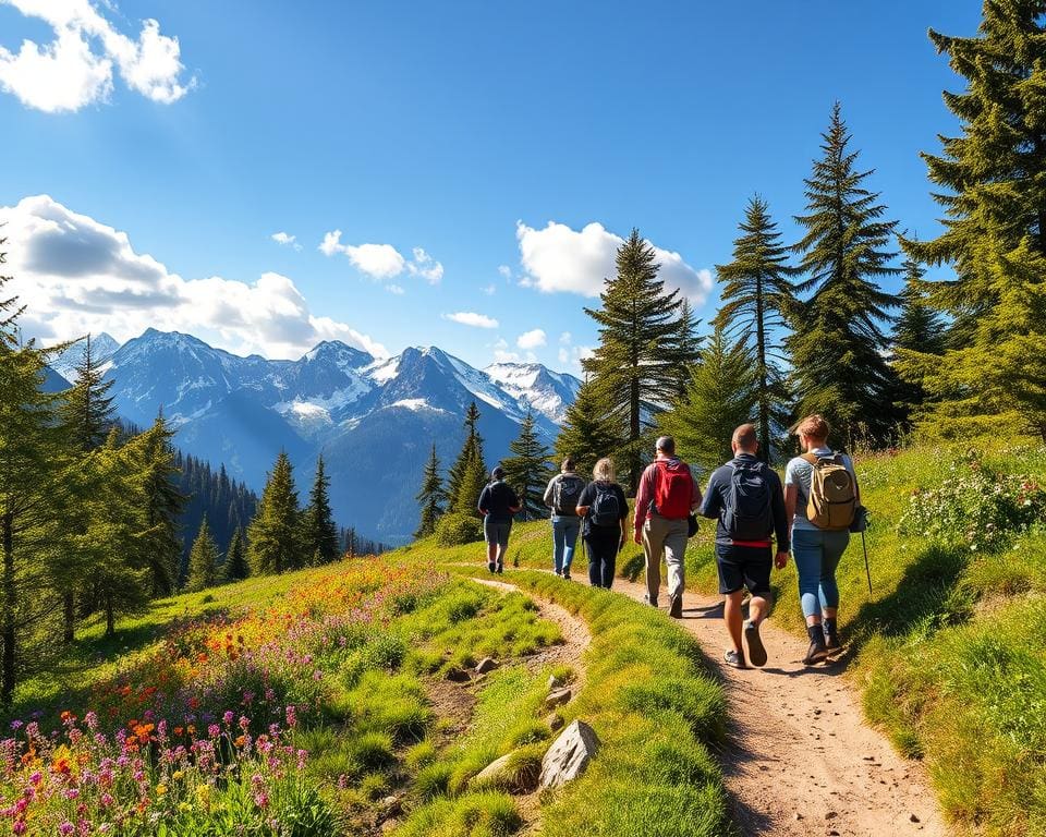
If you love the outdoors, Switzerland offers some of the finest Switzerland hiking routes in Europe. From high alpine ridges in the Swiss Alps hiking to gentle paths beside turquoise lakes, the choices suit a wide range of fitness levels and tastes.
This guide is written for walkers from the United Kingdom and other English-speaking visitors. You will find clear, practical advice for day walks, multi-day treks and family-friendly nature hikes Switzerland. The aim is to help you plan safe, enjoyable trips that fit your experience and schedule.
Over 65% of Switzerland is mountainous, with the Alps and the Jura shaping diverse terrain. Well-marked trails, maintained by the Swiss Hiking Federation, make hiking in Switzerland accessible. The extensive public-transport network, including Swiss Federal Railways (SBB) and PostBus, supports walk-in, walk-out itineraries across regions such as Valais, Bernese Oberland and Graubünden.
Read on for a clear structure: an overview of iconic trails and must-see landscapes, practical planning tips on logistics and safety, high-altitude alpine routes and refuges, and gentler lakeside and valley walks. Authoritative resources like SwissTopo maps, SBB timetables and regional tourism sites will be noted to help you plan every step.
Switzerland hiking routes: iconic trails and must-see landscapes
Switzerland offers a range of trails that suit both day walkers and multi-day trekkers. You can choose high alpine traverses, ridge walks, glacier viewpoints or gentle panoramic routes. Trains and mountain railways mean many routes start and end at easy access points without needing a car.
High-level overview of iconic Swiss trails
There are signature routes that define Swiss walking. The Haute Route Switzerland runs from Chamonix to Zermatt as a classic high-mountain traverse over several days. The Eiger Trail and the Jungfrau Region walks deliver dramatic views of the north face and linked single-day panoramas.
The Matterhorn area around Zermatt rewards you with classic alpine scenery ideal for Zermatt hiking. The Via Alpina crosses cantons in stages, creating varied multi-day options. Regional favourites include the Engadine valley trails, viewpoints over the Aletsch Glacier and walks through Swiss National Park in Graubünden.
Trail types vary from single-day panoramic routes to multi-day alpine traverses. Glacier viewpoints, ridge walks and valley circuits have approximate durations ranging from a couple of hours to a week or more. Popular transport links such as SBB, Gornergrat Railway and the Jungfraujoch/Grindelwald First lifts create loop and linear walk choices.
What makes these routes special for nature lovers
The scenery includes alpine meadows and endemic flora like edelweiss, larch woods and pristine lakes such as Oeschinensee and Bachalpsee. These Swiss scenic walks place you close to dramatic glaciers, waterfalls and clear, glacial streams.
Wildlife viewing is a highlight. You may spot ibex, chamois, marmots and golden eagles, particularly in protected areas such as Swiss National Park. Cultural landscapes add depth: high-alpine villages like Zermatt, Grindelwald and Lauterbrunnen show pastoral life, alpine dairies and mountain huts serving traditional Swiss dishes.
For photographers and contemplative walkers, clear air and dramatic light reward modest effort with memorable vistas. The Eiger Trail and Zermatt hiking routes give accessible viewpoints that make iconic Swiss trails especially satisfying.
Best seasons to hike iconic routes
Summer, from June to September, is the main season for high-alpine trails after the snow clears. Most mountain huts open and higher passes become accessible. July and August are warmest and busiest.
Late spring, May to June, suits lower valleys where wildflowers bloom while higher routes may still hold snow and need alpine experience. Early autumn, September to October, often brings stable weather and vivid larch colours with fewer crowds. Watch for early snow at altitude.
Winter conditions close many summer paths or turn them into routes that need winter skills. Low-elevation lakeside paths remain walkable and snowshoe options exist. Always check local tourist offices and avalanche bulletins to confirm conditions and the best time to hike Switzerland.
Planning your trek: logistics, safety and sustainable travel
Before you set off, take time to plan hiking Switzerland with clear goals. Shortlist routes that match your fitness, check seasonal access and book any overnight stays. Good planning cuts stress on the trail and improves hiking safety Switzerland for you and your group.
Use the Swiss hiking grades T1–T6 to match terrain to your skills. Pick T1–T2 for easy day walks, T3 for demanding mountain hikes and T4–T6 for exposed alpine ground. Count distance and elevation; aim for day hikes with under 1,000–1,200m ascent if you are fit but not yet an alpinist.
Consider snow and seasonal hazards. Avoid high passes early in spring or late in autumn unless you have experience with snow travel. Consult guidebooks, SwissTopo and local tourist offices when in doubt. For glaciated or technical routes, hire a certified UIAGM/IFMGA mountain guide.
Essential gear and clothing for Swiss conditions
Select reliable Swiss hiking gear that suits alpine weather and mixed terrain. Sturdy, well-broken-in boots are vital. Adopt a layered clothing system: base layer, insulating mid-layer and a waterproof, breathable outer shell.
Pack navigation tools, a charged phone with emergency contacts, headlamp, first-aid kit, knife or multi-tool and a whistle. For multi-day trips add a lightweight stove and water-treatment method. Seasonal extras include crampons, ice axe and gaiters for lingering snow, plus trekking poles for steep descents.
Check hut services before you go. Mountain huts often serve meals but can close outside peak season. Carry enough water where streams are unreliable and bring insect repellent for lower valleys.
Navigation, weather resources and emergency contacts
Rely on SwissTopo maps and apps for detailed planning. Use Komoot or Outdooractive for route previews and offline downloads. Download maps to your device; mobile signal weakens at altitude.
Monitor mountain weather Switzerland via MeteoSwiss. Consult avalanche forecasts from the SLF when snow is present. Save emergency numbers in your phone: 112 or 144 for rescue services and canton-specific alpine teams. Note nearest cable car stations and mountain huts before you leave and share your itinerary with someone at home.
Leave No Trace and sustainable hiking practices in Switzerland
Adopt sustainable hiking Switzerland habits to protect fragile alpine environments. Keep to marked paths in protected areas like the Swiss National Park. Do not feed wildlife and obey local signage to protect grazing and seasonal farming.
Carry out all litter and minimise single-use plastics. Use toilets at huts and stations when available. Travel by train, PostBus or regional rail to lower your carbon footprint. Stay in family-run guesthouses or mountain huts and buy local produce to support rural communities.
Alpine adventures: high-altitude routes and panoramic summits
If you aim for dramatic panoramas and thin-air challenges, the Swiss high mountains reward you with unforgettable days. Choose routes that suit your skill level and allow time for sensible acclimatisation Alps routines before pushing above 2,500 metres.
Sample high-altitude routes to consider
- Haute Route (Chamonix–Zermatt): a classic glacier-linked traverse between Mont Blanc and the Matterhorn region, usually 8–12 days and best with alpine experience or a guide.
- Grosse Scheidegg to Grindelwald and the Eiger Trail: dramatic north-face views for a full day or as part of a multi-day plan.
- Zermatt approaches: Gornergrat to Riffelsee and nearby climbs that frame the Matterhorn; expect route-finding and occasional snowfields.
- Bernina Range and Morteratsch Glacier in Graubünden: high passes and glacier viewpoints linking Engadin villages.
- Aletsch Arena trails around the UNESCO Aletsch Glacier for wide glacier vistas and long ridge walks.
Acclimatisation and altitude considerations
Altitude reduces available oxygen and can bring acute mountain sickness above about 2,500–3,000 m. Watch for headache, nausea, tiredness and sleep disruption. You should plan gradual gains in elevation, include rest days and follow the climb-high, sleep-low principle where possible.
Stay well hydrated and avoid heavy exertion during the first 24–48 hours above 2,500 m. If symptoms worsen, a controlled descent is the primary treatment. Be familiar with signs of severe conditions, such as HACE and HAPE, and carry a clear evacuation plan.
Mountain huts, refuges and multi-day itinerary tips
- Hut network: many mountain huts Switzerland are run by the Swiss Alpine Club or private operators. Huts offer bunks, meals and useful route advice. Book early for summer weeks.
- Facilities: expect dormitory sleeping, set evening meals and breakfast, limited hot showers and the need to state dietary needs in advance.
- Logistics: plan realistic daily stages and check lift and rail timetables for your start and finish points. Carry crampons and an ice axe when glacier travel is possible. Use a guide for technical glacier routes or exposed alpine summits Switzerland.
- Safety net: buy travel insurance that covers mountain rescue and consider guided support for glacier-linked traverses.
Gentle walks and family-friendly trails through lakes and valleys
You’ll find many family-friendly hikes Switzerland offers that suit all ages and abilities. Choose easy walks Switzerland routes with low elevation gain, clear waymarking and close links to rail or PostBus services. Trails such as the Oeschinensee circuit in Kandersteg are ideal: a short cable-car ride followed by mostly flat lakeside paths and alpine meadows that even allow pushchairs on some sections.
For short outings with big views, try the Bachalpsee from First in Grindelwald. The lift reduces effort, leaving a pleasant stroll to a mirror-like tarn framed by peaks. Lake Lucerne and the Rigi promenades combine lakeside walks Switzerland and gentle inclines accessed by cogwheel train, giving rewarding panoramas without steep climbs. Walensee and Seealpsee provide easy valley loops with picnic spots and calm waters for paddling or wildlife watching.
Educational family days work well in the Swiss National Park at Zernez, where well-signposted visitor trails explain local flora and fauna. When planning valleys hikes Swiss Alps, pick loops over long linear routes to avoid complex transfers and schedule short segments with rests. Pack layered clothing, spare footwear for children, insect repellent and snacks, and check weather forecasts before you set out.
Season matters: spring and summer bring wildflowers and warmer conditions, while autumn offers colour and fewer crowds but cooler temperatures. Many towns—Interlaken, Lucerne, Zermatt and St Moritz—serve as convenient bases with frequent regional transport to start points. These family-friendly hikes Switzerland and lakeside walks Switzerland let you enjoy alpine scenery at a relaxed pace, making them perfect for multi-generational outings.