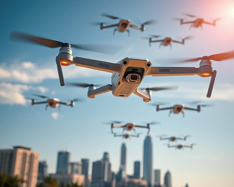
You are witnessing a step change in drone technology that matters for your operations, planning and investment decisions across the UK. Recent drone breakthroughs bring together smarter onboard AI, denser sensor suites and more efficient power systems to make autonomous drones safer, quieter and more capable than before.
Advances in machine learning now let platforms from DJI and Skydio navigate cluttered streets and complex sites with far less human input. Sensor fusion — combining LiDAR, RGB, thermal and radar — gives reliable situational awareness in poor light or adverse weather, so your missions run with fewer surprises.
Edge computing is reducing reliance on constant connectivity. That means real‑time decision making on the aircraft, shorter response times and lower data costs for businesses testing drone innovation in logistics or inspections. At the same time, improvements in batteries and alternative fuels extend range and payload, expanding commercial use cases in the UK drone industry.
These technological shifts are already lowering the cost of routine inspections, enabling faster last‑mile pilots and improving crop analytics for farmers. With support from the UK Civil Aviation Authority and initiatives such as the Future Flight Challenge, the path to regulated, large‑scale deployment of autonomous drones is becoming clearer for you as a user, operator or policymaker.
Emerging autonomy systems reshaping drone operations
You are living through a shift from manual piloting to intelligent aircraft that decide and adapt on their own. New autonomy systems blend advances in onboard AI drones with tried engineering to give you safer flights and steadier results.
Below are three focal areas changing how drones work for businesses and public services in the UK.
Advances in onboard AI and machine learning
Onboard neural networks now run navigation, object detection and mission planning without constant human input. Companies such as Skydio use deep learning for complex obstacle negotiation. Open‑source projects from Auterion and Parrot integrate AI modules into flight stacks, giving you more reliable performance.
Research teams at Imperial College and the University of Oxford publish work on multi‑agent coordination and reinforcement learning that improves collaboration between aircraft. The practical effect for you is less need for expert pilots and higher consistency for repetitive tasks.
Sensor fusion and perception improvements for complex environments
Sensor fusion brings LiDAR, RGB cameras, thermal imagers, radar and IMUs together to build robust 3D models. Solid‑state LiDAR is becoming lighter and more affordable. Radar helps detect obstacles through foliage or fog.
Combining inputs reduces false positives and raises drone perception in poor light or bad weather. That improvement supports safer BVLOS missions and better inspection detail for energy and infrastructure assets.
Edge computing and real-time decision making
Edge computing drones push inference and planning onto the aircraft, cutting latency and dependence on constant links. Hardware such as NVIDIA Jetson modules, Google Edge TPU and custom FPGAs enable on‑device processing for immediate responses.
With real-time drone control at the edge, your craft can reroute automatically when a hazard appears. That resilience matters in remote UK locations where connectivity can fail and lowers ongoing operational costs.
drone technology for commercial and industrial applications
The shift from experimental flights to widespread deployment is under way. You will see commercial drone applications moving into everyday business tasks, from moving parcels to scanning crops and checking pylons. These changes matter for your logistics, farming and asset management plans.
Logistics and last-mile delivery innovations
Operators such as Zipline, Wing and Amazon Prime Air have proven the concept for drone logistics in constrained corridors. Trials in the UK by Royal Mail partners test BVLOS routes and urban delivery corridors. You benefit from faster transport of urgent items and fewer delivery vehicle miles.
Delivery platforms use precision landing, capsule mechanisms and tethered release to protect goods. That technical progress supports last-mile drone delivery UK pilots that aim for same‑hour drops in selected towns.
Precision agriculture: crop monitoring and automated spraying
Precision agriculture drones now carry multispectral cameras and analytics that link to farm management systems. Companies like DJI Agras and AeroVironment supply spray platforms and imaging payloads to spot pest outbreaks and stress in fields.
Targeted spraying cuts chemical use through variable‑rate application and spot treatment. Your farm can gain clearer agronomic insight, lower input costs and tailored recommendations from routine drone surveys.
Inspection and maintenance in energy, construction and infrastructure
Inspection drones equipped with LiDAR, thermal sensors and high‑res cameras reduce risk to personnel while speeding fault detection. Energy and engineering firms such as National Grid, BP and Siemens run drone inspection programmes to monitor lines, turbines and solar arrays.
Automated flight routines and AI analytics rank defects so you can prioritise repairs. Energy infrastructure drones and BVLOS inspection fleets cut scaffolding needs and shorten time to repair across long corridors.
- Your outcomes: quicker response to faults, fewer site visits and clear digital records for asset life management.
- Operational note: working with certified service providers ensures regulatory compliance and data quality.
Regulation, safety frameworks and airspace integration
The rapid growth of commercial drone use has pushed policy makers and operators to rethink how you manage shared skies. You will see tighter drone regulation UK measures paired with technical systems that make urban and rural operations safer and more predictable.
Developments in Unmanned Traffic Management
UTM systems are central to scaling safe drone services. Trials led by the UK Civil Aviation Authority and NATS are testing corridor models and real‑time authorisations that support BVLOS regulation and routine flights beyond visual line of sight.
Commercial UTM providers combine mobile networks, radar feeds and local airspace data to give you dynamic airspace restrictions and geospatial awareness. This integration reduces delays for approvals and makes scheduling repeatable for urban deliveries.
Certification, standards and operator licensing trends
Regulators are shifting toward performance‑based rules that match fast innovation. You must align your operations with the correct category under the CAA framework and demonstrate competency through operator licensing and safety cases.
European and international work by EASA, ASTM and ISO aims to harmonise requirements for detect‑and‑avoid, data security and interoperability. Selecting platforms with recognised conformity statements simplifies audits and insurance assessments.
Collision avoidance, geo‑fencing and risk mitigation technologies
Manufacturers are embedding ADS‑B receivers and visual avoidance stacks to reduce mid‑air risk. Software‑defined geo‑fencing drones now interoperate with national aerodrome zones so you can enforce no‑fly limits at scale.
Robust collision avoidance drones, redundant sensors and automated emergency landing routines help you build stronger drone safety frameworks. Demonstrable mitigation lowers operational risk and can improve stakeholder confidence when you submit a safety case.
- Expect smoother approvals where UTM systems provide centralised traffic information.
- Prepare documentation that matches specific category requirements under current drone regulation UK guidance.
- Choose hardware and software with proven collision avoidance and geo‑fencing drones features to ease certification.
Hardware breakthroughs and enabling technologies
You will see drone hardware innovations improving endurance and payload capability. Advances in drone batteries, from higher energy‑density lithium‑ion and emerging lithium‑sulphur cells to hydrogen fuel‑cell prototypes, extend flight time and reduce the need for frequent swaps. More efficient brushless motors and refined propeller design mean propulsion systems can carry heavier or more complex payloads without sacrificing range.
Miniaturised, higher‑performance drone sensors and payload technology are making surveys and inspections far more detailed. Manufacturers such as Velodyne, Ouster and Hesai now offer compact LiDAR drones that fit small airframes, while Sony, Teledyne FLIR and MicaSense supply multispectral, hyperspectral and thermal cameras tailored to mapping, agriculture and condition monitoring. Modular mounts and standardised interfaces let you swap sensors quickly to suit each mission.
Communications and navigation improvements boost resilience in real operations. The use of 4G/5G links and satellite connectivity supports real‑time transmission and beyond‑line‑sight tasks, while multi‑constellation GNSS with RTK/PPK gives centimetre‑level positioning. Vision‑based navigation, magnetic and ultrasonic aids provide redundancy when GPS is degraded, so your missions stay on course in challenging environments.
Manufacturing and materials work hand in hand with acoustic and efficiency gains. Carbon‑fibre and polymer composites, plus topology‑optimised parts produced by additive manufacturing, reduce weight and cost. Noise‑reducing propeller geometry and sound‑dampening measures lower the acoustic footprint, helping drones meet urban limits and improving community acceptance for commercial operations.